METARs Tab
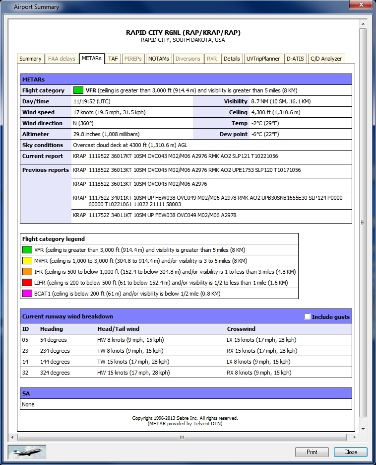
METARs shows meteorological activity for a specific airport. Surface Summary is a METAR (Meteorological Aviation Routine Weather Report) product that delivers hourly surface weather observations and reports. Updates are loaded every 5 minutes to have the most up-to-date weather data. Surface Summary can also be animated, see Weather & Dynamic Overlays. This is a world-wide view of flight category conditions.
To view METARs tab
Right-click on any airport and select Airport Summary from the Context menu.
The METARs tab ![]() appears
appears
METARS
Airports are color coded to show ceiling / visibility range.
|
Color |
Description |
Ceiling |
Visibility |
|---|---|---|---|
|
Green |
VFR |
>3k ft |
> 5 mi. |
|
Yellow |
MVFR |
1k - 3k |
3 - 5 mi. |
|
Orange |
IFR |
500 - < 1k ft |
1 - < 3 mi. |
|
Red |
LIFR |
200 - < 500 ft |
1/2 to < 1 mi. |
|
Pink |
BCAT1 |
< 200 ft |
< 1/2 mi. |
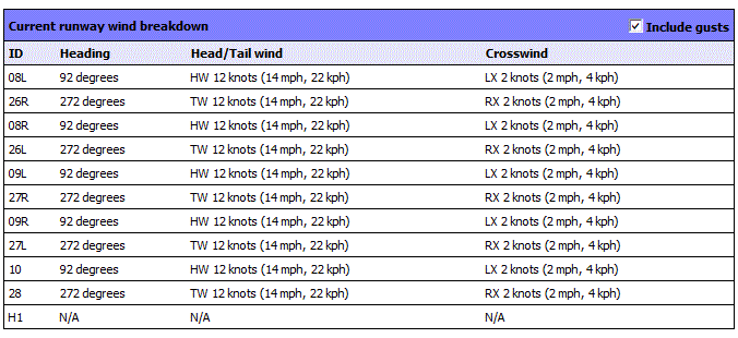
Winds are broken down by runway ID number, and include headings (in degrees), head and tail winds (in knots, mph, and kph), and cross-winds (in knots, mph, and kph). Wind speed is calculated by using the base wind-speed and cross-winds analysis is 90° perpendicular to the runway. To factor in wind gusts, click the Include Gusts check box to adjust wind-speed calculations.

